29. August 2004, it is a sunday, the weather is very nice, about 23°C warm. meeting point is in the middle of the village around 12.30 hrs. a walk of approx. 1 1/2 hours, from 900 to 1400 meters over sea level, leads us to the north position. the walking is rather steep.
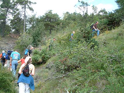
walking up to the north position
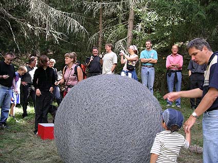
arrived at z'gartu the people of termen wellcome us with a cool beer, fine mountain water from the spring or whithe wine of the region, plane cheese and walliserbred.
many thanks to the village of termen for the beautiful vernissage, the granted right of hospitality for the northern sphere and the big assistance with the realization.
arrived at 1'400 Meter over sea level
foto: werner göldi-schmidli
foto: werner göldi-schmidli
the northern sphere together with the map of the position of the southern sphere, in-milled in a metal plate, on a red base.
longitude: 8° 2' 42" east
latitude: 46° 20' 11" north
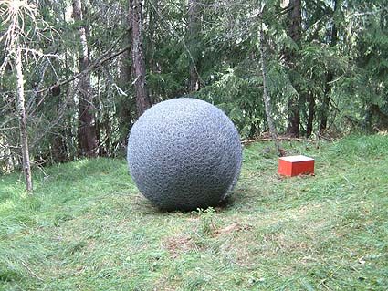
the northern sphere at its final destination
direct continuation of the virtual line into the sky
view of the northern sphere up to the sky